X
X
Query / Suggestions /Grievance
Mail Us at
Feedback@gniot.net.in
X
Saturday
Venue:- GNIOT Campus
Time:- 10:00 AM

Overview Vision & Mission PEO-PO-PSO HOD’s Message Course Faculty Achievements Students Achievement Students Clubs Testimonials Labs Department Advisory Committee(DAC)
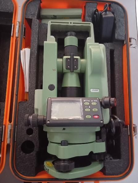
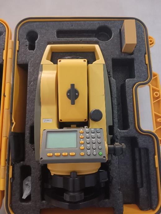
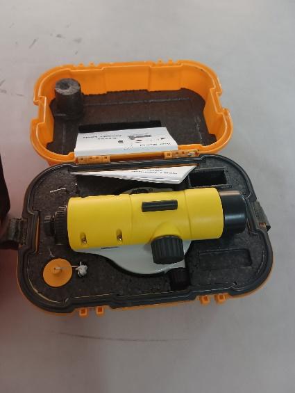
Surveying Lab
The Surveying Laboratory is well equipped with instruments for measuring distances: vertical and horizontal, bearings: compass and elevation: automatic level. The measurements taken by these equipment are used for setting out highway and railway curves, performing levelling surveys, calculating the height of structures and for applying corrections to geodetic observations. The major equipment in our laboratory includes: Chain, Tape, Theodolites: Vernier, Electronic, Automatic Level, Plane Table and its Accessories, Ranging Rod, Levelling Staff, Plumb Bob, Pegs, tripods and other accessories. The Geoinformatics Laboratory is well equipped with modern surveying equipment for measuring distances, angles: vertical, horizontal and coordinates. The lab also consists of equipment used for performing measurements related to area, volume calculation and interpretation of aerial photographs and satellite images to extract information for decision making. The major instruments in our laboratory includes: Total Station, Hand held GPS, Mirror stereoscopes, Prism, Ranging Rod, Plumb Bob, Pegs, tripods and other accessories
Environmental Engineering lab
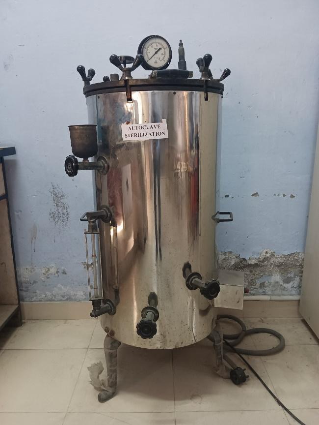
The Environmental engineering lab facilitates the students to understand the practical aspects of environmental engineering involved in water supply engineering. In this lab various instruments like fluoride content with multi-parameter, Dissolved oxygen Multi-parameter, BOD Incubator & COD Meter, Particulate matter in air with HVAS, Level of noise pollution with noise meter, pH of water with pH meter, Turbidity of water with multi-parameter are placed. With the help of following instruments various tests are conducted which are as follows - BOD of Sewage water, COD of sewage water, Level of Dissolved Oxygen in water and wastewater, Turbidity Determination in water and waste water, Determination of Fluoride Content in water, Determination of pH of Water and waste water, Determination Level of Noise, Determination of Particulate Matter in Air.
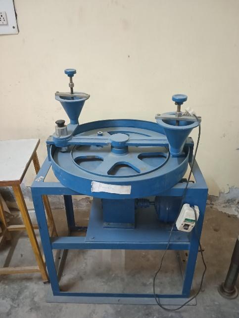
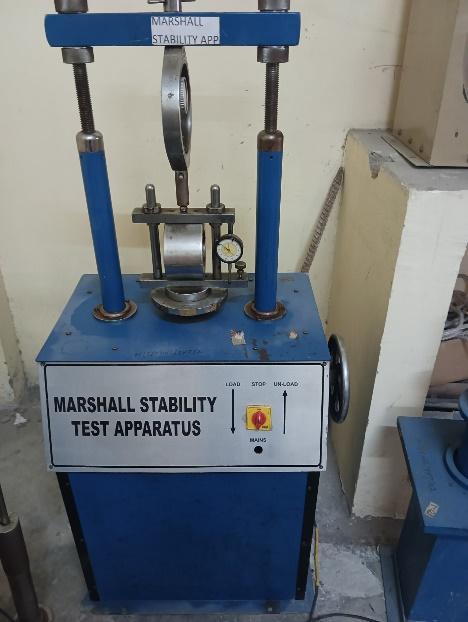
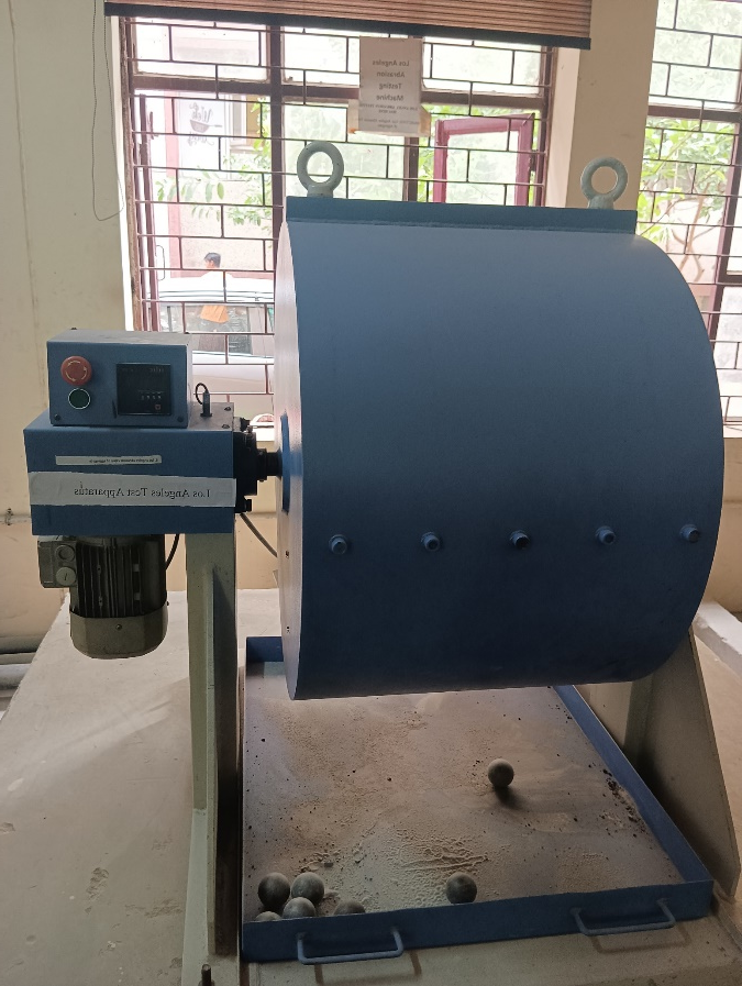
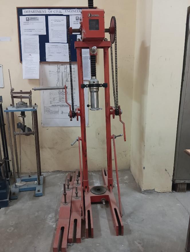
TRANSPORTATION LAB
The Transportation Engineering Laboratory is well equipped with instruments related to highway material testing and Traffic studies. The list of some of the experiments that can be conducted in the transportation engineering laboratory are as follows- Aggregate Test, Crushing Test, Impact Test, Los Angeles Abrasion Test, Flakiness and Elongation Index Test, Bitumen Tests, Penetration Test, Softening Test, Viscosity Test, Flash and Fire Point Test, Ductility Test, Stripping Test, Speed Radar Gun.
GEOTECHNICAL LAB
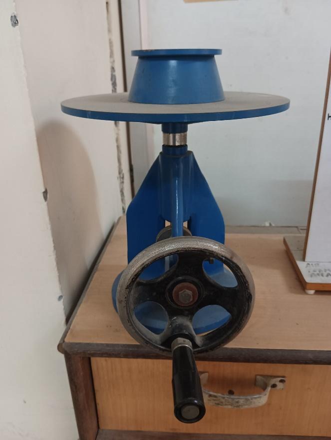
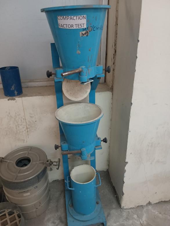
The Geotechnical engineering lab facilitates the students to understand the practical aspects of soil mechanics and foundation engineering. The lab is well equipped with instruments and machines to handle various tests like Specific Gravity, water content, grain size analysis consistency limits, permeability, OMC, MDD, Shear Strength of soil, which are conducted with the help of the following instruments- Pycnometer, Oven, Casagrande Apparatus, Standard Proctor Apparatus, Constant & Falling Head Permeameter, IS Sieves & Hydrometer, Direct Shear Apparatus, Triaxial Shear Apparatus, Sand Replacement & Core cutter Apparatus, Standard Penetration Test Apparatus.

BMC LAB
STRUCTURAL LAB
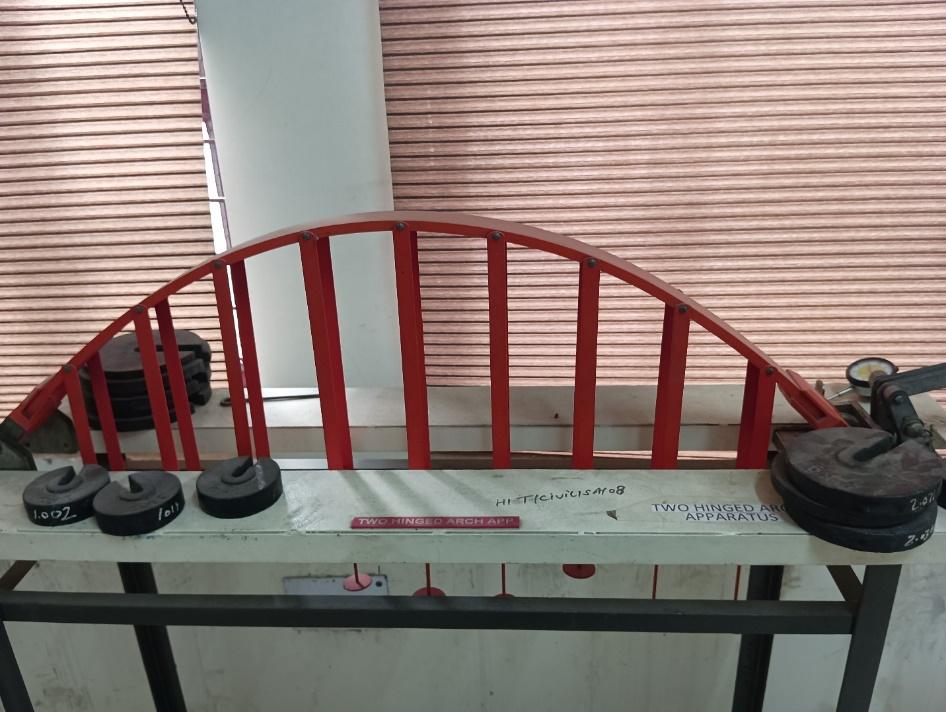
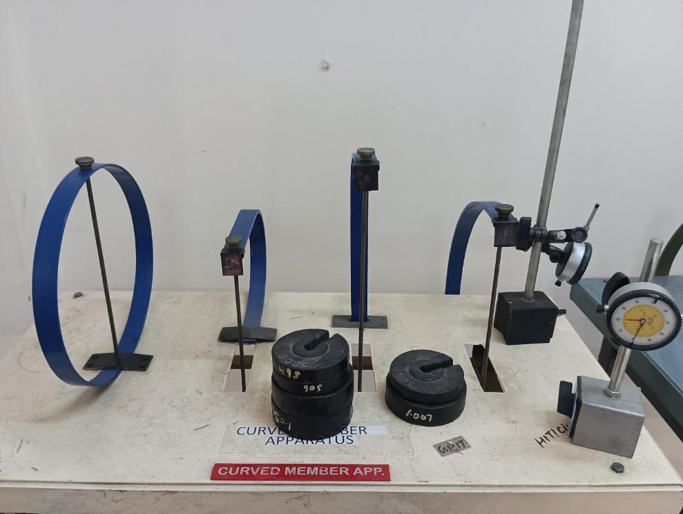
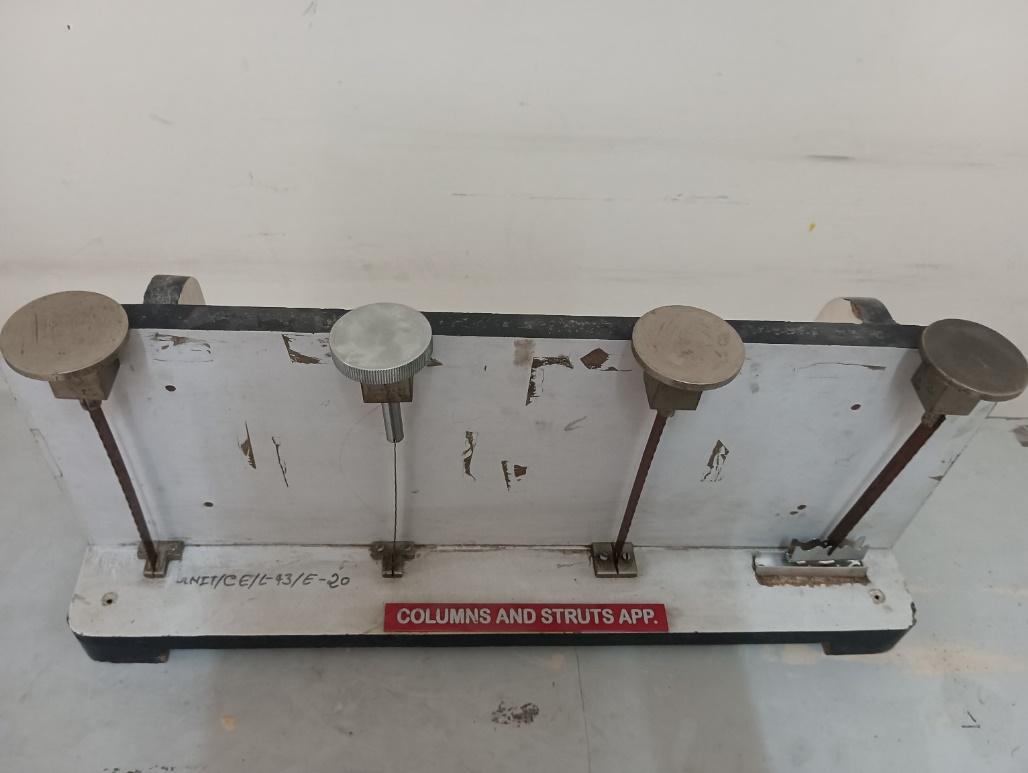
The structural analysis lab is well equipped and helps to understand the practical behaviour of the physical structural elements like beams, arches, columns and struts etc. The list of apparatus, which are being used for conducting experiments in the Structural analysis laboratory are as follows - Elastic properties of deflected beam apparatus, Elastically coupled beam apparatus, Apparatus for verification of Clark's Maxwell reciprocal theorem, Two hinged arch apparatus, Curved member apparatus, Redundant joint apparatus, Unsymmetrical bending apparatus, Three hinged arch apparatus, Column and Strut apparatus.
FLUID MECHANICS AND HHM LAB
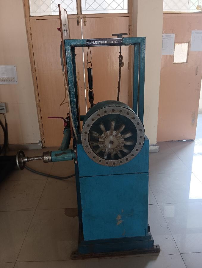
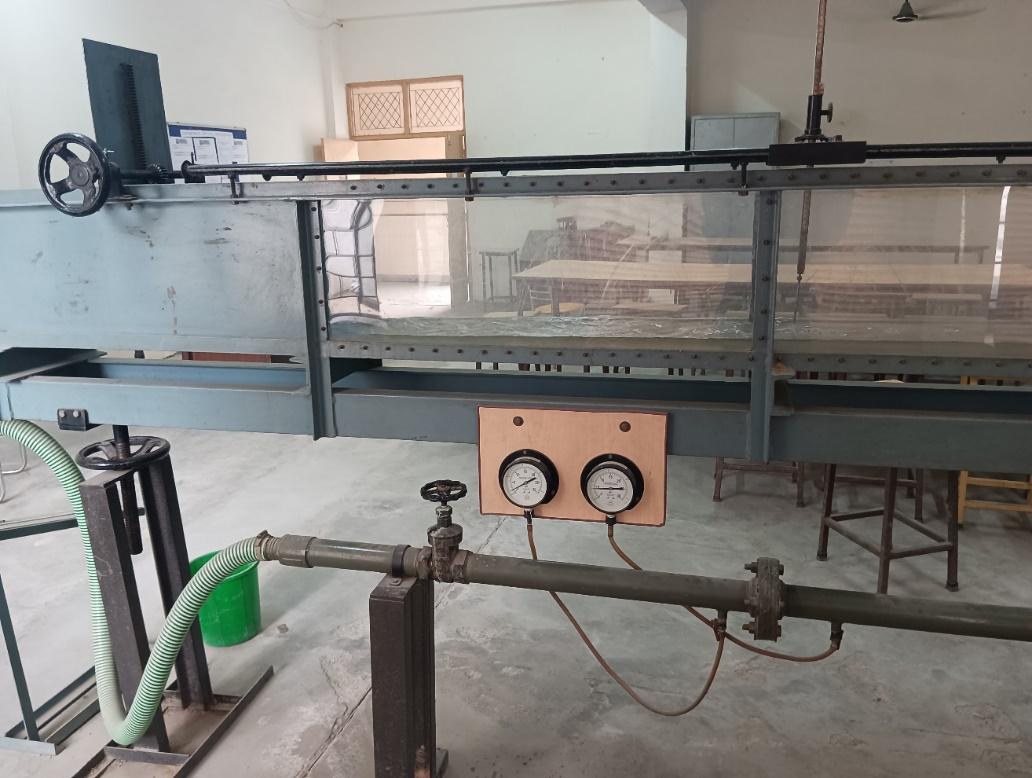
This lab has basic fluid mechanics set-up. The lab is equipped with different flow measuring set-ups such as Venturimeter, Orifice-plate, Pitot tube, etc., where students can visualize the basic theory of how the flow meter works. The lab also has Reynolds setup, free-forced vortices setup, flow over open channel and impact of jet set-up, where students can fortify their theoretical knowledge. Hydraulics engineering is concerned with the flow and conveyance of fluids, principally water. Hydraulic engineering is the application of fluid mechanics principles to problems dealing with the collection, storage, control, transport, regulation, measurement, and use of water. Application of hydraulics engineering includes fluid mechanics, fluid flow, behaviour of real fluids, hydrology, pipelines, open channel hydraulics, mechanics of sediment transport, physical modelling, hydraulic machines, and drainage hydraulics.
CAD LAB
CAD Lab of this department was established for concept design and product realization. This lab is to primarily facilitate students to evolve concepts and convert them into a complete product. The lab covers STAAD-PRO (Structure analysis and design software), PLAXIS (Geotechnical software for analyzing and designing foundations), Water Gems, Sewer Gems covering water supply and sewerage systems. It also covers working on Project Planning and Management softwares like Primavera & MS Project latest versions to make our students well versed with analysis and design of structures and also inculcate managerial skills.
The CAD Laboratory is a central facility of the institute where all undergraduate and postgraduate students, and faculty members can work with the sophisticated 2-D & 3-D design and analysis software. They can learn to use the latest software and carry out their research work. The CAD Laboratory has computers with the latest configurations connected with a high-end server through networking.
The Software available in the CAD lab are:
AutoCAD
AutoCAD is a commercial computer-aided design (CAD) and drafting software application. Developed and marketed by Autodesk, AutoCAD was first released in December 1982 as a desktop app running on microcomputers with internal graphics controllers. Before AutoCAD was introduced, most commercial CAD programs ran on mainframe computers or minicomputers, with each CAD operator (user) working at a separate graphics terminal.

PRIMAVERA
Primavera is an enterprise project portfolio management software. It includes project management, scheduling, risk analysis, opportunity management, resource management, collaboration and control capabilities, and integrates with other enterprise software such as Oracle and SAP’s ERP systems. Primavera was launched in 1983 by Primavera Systems Inc., which was acquired by Oracle Corporation in 2008
STAAD PRO
STAAD or (STAAD.Pro) is a structural analysis and design software application originally developed by Research Engineers International in 1997. In late 2005, Research Engineers International was bought by Bentley Systems.
STAAD.Pro is one of the most widely used structural analysis and design software products worldwide. It can apply more than 90 international steel, concrete, timber and aluminium design codes.
It can make use of various forms of analysis from the traditional static analysis to more recent analysis methods like p-delta analysis, geometric non-linear analysis, Pushover analysis (Static-Non Linear Analysis) or a buckling analysis. It can also make use of various forms of dynamic analysis methods from time history analysis to response spectrum analysis. The response spectrum analysis feature is supported for both user defined spectra as well as a number of international code specified spectra.
Additionally, STAAD.Pro is interoperable with applications such as RAM Connection, AutoPIPE, SACS and many more engineering design and analysis applications to further improve collaboration between the different disciplines involved in a project. STAAD can be used for analysis and design of all types of structural projects from plants, buildings, and bridges to towers, tunnels, metro stations, water/wastewater treatment plants and more.

QGIS
IS is a free and open-source cross-platform desktop geographic information system (GIS) application that supports viewing, editing, printing, and analysis of geospatial data. QGIS functions as geographic information system (GIS) software, allowing users to analyze and edit spatial information, in addition to composing and exporting graphical maps. QGIS supports raster, vector and mesh layers. Vector data is stored as either point, line, or polygon features. Multiple formats of raster images are supported, and the software can georeference images.
QGIS supports shapefiles, personal geodatabases, dxf, MapInfo, PostGIS, and other industry-standard formats. Web services, including Web Map Service and Web Feature Service, are also supported to allow use of data from external sources.
QGIS integrates with other open-source GIS packages, including PostGIS, GRASS GIS, and MapServer.[4] Plugins written in Python or C++ extend QGIS's capabilities. Plugins can geocode using the Google Geocoding API, perform geoprocessing functions similar to those of the standard tools found in ArcGIS, and interface with PostgreSQL/PostGIS, SpatiaLite and MySQL databases. QGIS can also be used with SAGA GIS and Kosmo.
ILWIS
Integrated Land and Water Information System (ILWIS) is a geographic information system (GIS) and remote sensing software for both vector and raster processing. Its features include digitizing, editing, analysis and display of data, and production of quality maps. ILWIS was initially developed and distributed by ITC Enschede. (International Institute for Geo-Information Science and Earth Observation) in the Netherlands for use by its researchers and students. Since 1 July 2007, it has been released as free software under the terms of the GPL-2.0-only license. Having been used by many students, teachers and researchers for more than two decades, ILWIS is one of the most user-friendly integrated vector and raster software programmes currently available. ILWIS has some very powerful raster analysis modules, a high-precision and flexible vector and point digitizing module, a variety of very practical tools, as well as a great variety of user guides and training modules all available for downloading. The current version is ILWIS 3.8.6. Similar to the GRASS GIS in many respects, ILWIS is currently available natively only on Microsoft Windows. However, a Linux Wine manual has been released.

EPANET
EPANET is a public domain, water distribution system modeling software package developed by the United States Environmental Protection Agency's (EPA) Water Supply and Water Resources Division. It performs extended-period simulation of hydraulic and water-quality behavior within pressurized pipe networks and is designed to be "a research tool that improves our understanding of the movement and fate of drinking-water constituents within distribution systems". EPANET first appeared in 1993.
EPANET 2 is available both as a standalone program and as an open-source toolkit (Application Programming Interface in C). Its computational engine is used by many software companies that developed more powerful, proprietary packages, often GIS-centric. The EPANET ".inp" input file format, which represents network topology, water consumption, and control rules, is supported by many free and commercial modeling packages. Therefore, it is arguably considered as the industry standard.
